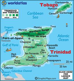
Trinidad and Tobago
Trinidad and
Tobago,
officially the Republic of Trinidad and
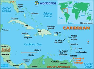
Tobago, is an island country off the northern edge of South
America, lying just off the coast of northeastern Venezuela
and south of Grenada
in the Lesser Antilles. Usually considered
part of the Caribbean, it shares maritime boundaries with other nations including Barbados, Grenada,
Guyana and Venezuela. The country covers an
area 5,128 square kilometers and consists of two main islands, Trinidad and Tobago,
with numerous smaller landforms..
The island
of Trinidad was a Spanish
colony from the arrival of Christopher Columbus in 1498 to 1797. During the
same period, the island
of Tobago changed hands
among Spanish, British, French, Dutch and Courlander colonizers. Trinidad and Tobago (remaining separate until
1889) were ceded to Britain
in 1802 under the Treaty of Amiens. The country Trinidad and Tobago obtained
independence in 1962, becoming a republic in 1976. Unlike most of the
English-speaking Caribbean, the country's
economy is primarily industrial, with an emphasis on petroleum and petrochemicals.